Apart from growing in numbers, travel series are rapidly specializing to take advantage of niche markets and travel trends. In contrast to 36 series covered in the November issue (see LJ 11/15/2000, p. 32), the 30 series below are aimed at travelers with an interest in a specific activity. And, like most of the general series, they, too, strive to balance practical tourist information with background information on culture and history.
A recent Dorling Kindersley study revealed the increasing popularity of family travel and the concomitant need for guides that offer a wealth of ideas for traveling with kids of all ages. Moreover, the American road trip is alive and well. According to Jane Glennon of Fodor’s, “A whopping 79 percent of Americans travelling domestically do so by car, truck, or RV.”
New York Public Library’s Marsha Spyros recognizes a unique role for many specialized guides in libraries. “Besides being checked out for travel guidance, as they are often replete with useful information on the subject rather than the location they cover,” says Spyros. This explains why some of the series below would make a successful crossover into another collection. For example, some of the food guides could go in cooking collections. Stars are explained more fully within the annotations.
Legend: * Poor/Insufficient ** Satisfactory/Bare Bones *** Good/Ample **** Excellent/Comprehensive
 Adventure & Recreation Guides
Adventure Guides. Hunter Pub. pap. $12.95-$19.95 http://www.hunterpublishing.com/
Hunter’s signature series aims to mimic the general guides while emphasizing outdoor activities, such as hiking, biking, and canoeing in national and international tourist spots. However, while these do provide plenty of information in a succinct writing style, the cluttered format and bulky size make them impractical as carry-ons. Further, the black-and-white photographs are often indecipherable, and the impressive number of maps does not make up for their clumsy design. For the independent daredevil. Updated biannually. 48 titles.
Writing ** Photos * Maps ** Index **** Binding & Paper ** Ease of Use ** Insider info ****
NEW! Bicycling America’s National Parks. Countryman Pr. pap. $17.95-$18.95 http://www.countrymanpress.com/
The first of its kind, this series launched in 2000 with guides to Utah/Colorado and California and added Washington/Oregon and Arizona/New Mexico this fall. Besides recommending bicycling treks in various national parks, they include rides outside the parks’ borders for more ambitious bicyclists. The maps feature easily recognizable symbols and nicely compliment the text. Though the photographs could have been more relevant, the books are clearly organized and practical for traveling. Updates planned every five years. 4 titles.
Writing *** Photos ** Maps **** Index *** Binding & Paper *** Ease of Use *** Insider info ***
 NEW! Cycling Guides. Lonely Planet. pap. $19.99-$21.99 http://www.lonelyplanet.com/
This series sets out to suggest the most exciting (and daring) bike rides and to provide enough rudimentary information on accommodations, dining, and culture to obviate the need for another guide. These resemble the staple Lonely Planet guides in format, quality of photos, and direct writing. The most distinguishable chapter “Your Bicycle,” provides in-depth information on bike preparation, maintenance, and safety. Locations covered include New Zealand, France, Britain, and Australia. Updates planned every two years. 4 titles.
Writing *** Photos ** Maps **** Index *** Binding & Paper *** Ease of Use *** Insider info ***

Discovery Travel Adventures. Langenscheidt. pap. $19.95. http://www.travelchannel.com
Published in conjunction with the Insight Guides, this is the only series that stresses what to do over where to do it. Hence, each is named after an activity (e.g., Bird Watching, Backcountry Treks, Scuba Diving), rather than a North American destination. The books consist of two clearly defined sections; first, preparation; second, the main attraction. The crossover value of these books makes them a unique addition to all adventure collections. Their eye-catching photographs, ample tourist information, glossy paper, and superb binding enhance their appeal. Most likely to be updated biannually. 11titles.
Writing *** Photos **** Maps *** Index ** Binding & Paper ** Ease of Use *** Insider info ***
 50 Hikes. Countryman Pr. pap. $16.95 http://www.countrymanpress.com/
This series, which began in 1973, covers about a dozen U.S. states, including Virginia, Ohio, and North Carolina. Aimed at day-hikers and backpackers, it provides meticulous directions and suggest 50 hikes, ranging from enjoyable strolls to several-day backpacking trips. For each hike there is information on total distance, hiking time, and vertical rise as well as a map, which tends to be a bit cluttered. The format is consistent, the writing slightly uneven. These do not include accommodations, but many embarking on such hikes may want to camp outside anyway. Updated every five years. 21 titles.
Writing ** Photos ** Maps *** Index ** Binding & Paper ** Ease of Use *** Insider info ***
Foghorn Outdoors. Avalon. pap. $15.95-$20.95 http://www.foghorn.com/

These U.S.-oriented guides comprise several series that cover camping, hiking, fishing, boating, golf, waterfalls, beaches, and other outdoor fun. Written by local experts, they are easy to read and teem with practical information. The thorough index and abundance of useful maps make the absence of photographs less noticeable; the tone is at times reminiscent of Bill Bryson. The diversity of interests make these valuable to collect. Updated every two or three years. 31 titles.
Writing *** Photos NONE Maps *** Index **** Binding & Paper *** Ease of Use ** Insider Info ***
 Frommer’s Great Outdoor Guides. IDG. pap. $16.99-$17.99. http://www.frommers.com/
Like Frommer’s destination guides, these U.S.-based books are very detailed but have a more decipherable format. And like the Cycling Guides, they aim to provide enough travel information to serve as self-sufficient sources. But, unlike the majority of series, which target one activity, this one packs a variety of outdoor experiences into each guide (e.g. birdwatching, canoeing, rock climbing). It even includes references to other sources, such as books and videotapes. Regrettably, there are no photographs. Ideal for travelers looking for a constant change of scenery and pace. Updated biannually. 5 titles.
Writing *** Photos NONE Maps ** Index *** Binding & Paper *** Ease of Use **** Insider Info ****
Inside Out. Sasquatch. pap. $16.95-$18.95. http://www.sasquatchbooks.com/

These bulky guides to the West Coast are written by and for locals traveling in their state. Highlighting a wealth of outdoor experiences, they uncover the wild, unexplored side of California, Oregon, Washington, and British Columbia. Coverage of urban areas emphasizes their natural riches, such as parks, beaches, and rivers. The restaurant and lodging reviews (sans sponsors) are condensed from the publisher’s Best Places guides and feature a useful star rating system. A lack of maps in many of the guides contrasts with valuable insider’s information. A good purchase for regional libraries. Updated every four years. 6 titles.
Writing *** Photos NONE Maps ** Index *** Binding & Paper *** Ease of Use **** Insider Info ****
Covering the United States by state (Vermont, Indiana, Colorado) or town/city (Moab, Boston), these scrupulously describe each location’s 50 best bike rides and include lists of campgrounds and local festivities. Thorough introductions stress safety. The plentiful photos are blurry and muddling at the best, and the index is skimpy. The maps, on the other hand, are conveniently large and unadorned with symbols. Similar to the Cycling Guides, these are not as visually alluring. Updated every two or three years. 12 titles.
Writing **** Photos * Maps *** Index * Binding & Paper *** Ease of Use *** Insider Info ***
Nature Walks/Hikes. Appalachian Mountain Club. pap. $10.95-$14.95. http://www.outdoors.org/

In contrast to other walking series, this emphasizes traveling with children of all ages and explores natural history. Covering various U.S. regions such as New York City, Northern Vermont, etc., the series provides detailed information on how to help children enjoy walking as much as adults do. The regions in each guide are divided into five or more walks. Unfortunately the personal-style writing is a bit clichéd, and the maps are rudimentary. Updated every five years. 14 titles.
Writing ** Photos ** Maps *** Index *** Binding & Paper *** Ease of Use **** Insider Info ****
 Periplus Action Guides. Periplus Editions: Tuttle Pub. pap. $24.95. http://www.tuttlepublishing.com/
This dynamic-looking series includes four guides on diving (Indonesia, Australia, Southeast Asia, and Bali); two on surfing (Indonesia and Australia); and one on birding (Indonesia). Written by experts in the field, it radiates with stunning photography, superb large-scale marine maps, and an abundance of useful charts. The ads are rather annoying, and the concluding section on practicalities is overbroad. Like the Discovery Travel Adventures, these stress activities over locations. Updated biannually. 7 titles.
Writing ** Photos ** Maps *** Index *** Binding & Paper *** Ease of Use **** Insider Info ****
Time Out Books of Walks. Penguin. pap. $14.95. http://www.timeout.com/

This series targets urban travelers who prefer to see the world’s greatest cities – London, New York, Paris – by walking. The design is similar to the staple Time Out guides, but each guide here offers 20 or more walking tours by a different contributor – usually a novelist or a historian. Some of these are theme walks, and many make for great armchair reading. The practical maps clearly show the route of each walk. Updates planned every two or three years. 4 titles.
Writing ** Photos ** Maps *** Index *** Binding & Paper *** Ease of Use **** Insider Info ****
 Winter Trails. Globe Pequot. pap. $14.95. http://www.globe-pequot.com/
This small but thriving series targets winter sport aficionados, highlighting such activities as cross-country skiing and snowshoeing. While providing detailed information on terrain, facilities and local events, the guide skimp on accommodations, dining, and culture. All feature a three-tier classification system for trail difficulty (easy, more difficult, most difficult) and large black-and-white maps, which are somewhat hard to decode. A comprehensive index would significantly increase the guides’ overall usefulness. Locations covered include Wisconsin, Colorado, and Vermont/New Hampshire. Updated every three years. 7 titles.
Writing ** Photos ** Maps *** Index NONE Binding & Paper ** Ease of Use ** Insider Info ***
Guides for drivers
NEW! Signpost guides. Thomas Cook Pub., dist. by Globe Pequot. pap. $22.95.
 http://www.thomascook.com/
Covering various European and North American regions, these are designed to serve as tour guides for those who prefer traveling by car and alone. Chapters focus on a specific locale (e.g. Key West), with major sites and suggested tours. The photos are varied and engaging, the numerous maps well-designed. Updates planned biannually. 20 titles.
Writing *** Photos ** Maps **** Index *** Binding & Paper **** Ease of Use *** Insider Info ****
 Travel Smart Guides. John Muir Pub. pap. $16.95 www.travreflib.com/Publishers/johnmuir.htm
This series only covers North America, but unlike Signpost, it is more suitable for families and for shorter trips, lacking much information on lodging or dining. Minor differences aside—the maps are not as attractive, and there are few photographs – the two series are quite similar and will attract similar audiences. Updated every two or three years. 33 titles.
Writing *** Photos * Maps ** Index *** Binding & Paper ** Ease of Use *** Insider Info ****
NEW! Fodor’s Road Guides USA. Fodor’s. pap. $16. http://www.fodors.com/

Kicking off in April 2001, this series is geared toward those driving through small towns with little time to spend and covers three or more states in each guide. Although it includes some information on attractions, it places special emphasis on lodging and dining. In contrast to other Fodor’s series, this one has a cluttered format and undersized fonts, and looks rather parsimonious. The upside is the short, snappy writing and the many helpful road maps. Planned annual updates. 15 titles.
Writing *** Photos NONE Maps *** Index NONE Binding & Paper ** Ease of Use ** Insider Info **
 Road Trip USA. Avalon. pap. $19.95-$24. http://www.travelmatters.com/
The most adventurous of the driving series, this one focuses on less-traveled two-lane highways. Laden with historical and cultural information and high-quality maps and photos, this series consists of the original comprehensive guide, Road Trip USA, which belongs in libraries that can order only one book from the series; the regional guide to California and the Southwest, and the pocket-size versions, called USA Getaways, which focus on one city and are intended for weekend escapes. Updated biannually. 7 titles.
Writing *** Photos *** Maps *** Index *** Binding & Paper **** Ease of Use *** Insider Info ****
Guides for art and book lovers
NEW! City secrets. The Little Bookroom. $19.95. http://www.citysecrets.com/

What sets this series apart are the opinionated (even biased), passionate recommendations from some 100 prominent architects, archaeologists, and historians emphasizing hitherto ignored artwork. The writing is elegant and the maps, though smaller than average, are useful. Another unique quality is the clothbound old-fashioned cover. The section for jotting notes will surely get used up quickly by patrons. There is some info on restaurants and shops. Forthcoming titles will cover Florence, Venice, and the towns of Italy and New York. Planned to be updated annually. 4 titles.
Writing **** Photos NONE Maps *** Index *** Binding & Paper **** Ease of Use *** Insider Info ****
Little-Known Museums In and Around… Abrams. pap. $19.95. http://www.abramsbooks.com/

This series only focuses on major metropolitan areas of Europe. Written by Rachel Kaplan, an international journalist who heads a cultural tourism company in Paris, this too, focuses on the unnoticed. It should appeal to locals as well as regular visitors looking for new discoveries. What immediately stands out are the expert photos, which reveal each museum’s contents. Disappointingly, each guide contains only one map showing museum locations, but it inadequate for directions. No updates planned. 4 titles.
Writing **** Photos NONE Maps *** Index *** Binding & Paper **** Ease of Use *** Insider Info ****
The Used Book Lover’s Guide. Book Hunter Pr. pap. $17.95-$19.95
 http://www.bookhunterpress.com/
Made up of seven regional guides (e.g. New England, Mid-Atlantic States, Pacific Coast States), this series covers over 7900 used book dealers in the United States and Canada. It provides useful information for those visiting in person, searching for books online, or ordering by phone or mail. Bulky, heavy, and with a handbook format, the guides are organized geographically by state and alphabetically by location and dealer. For each dealer there is a description of the stock, owner and payment information, travel directions, and more. The maps, although quite useful, are scarce and do not compliment the driving directions. Revised every three or four years. 7 titles.
Writing *** Photos NONE Maps * Index **** Binding & Paper ** Ease of Use *** Insider Info ***
Guides for family travel
NEW! Around… with kids. Fodor’s. pap. $10. http://www.fodors.com/
 These fun, pocket-size guides suggest 68 things to do with kids in major U.S. cities. The sites covered include museums, toy stores, puppet theaters, and much more. Scattered throughout are useful sections on trivia about each site (“Hey Kids!”) and info on “Kid-Friendly” restaurants. Written in a friendly tone, these are suitable for both adults and their children. Kids will find the cheerful illustrations amusing. Note: these small, light books won’t stand up to heavy use. Planned to be updated biannually. 7 titles.
Writing **** Photos NONE Maps NONE Index ** Binding & Paper * Ease of Use *** Insider Info **
Fun places to go with children. Chronicle. pap. $11.95. http://www.chroniclebooks.com/

Packed with information on anything and everything related to traveling with kids, this is the most thorough of the sites in this category. The straightforward, unadorned writing, the lack of amusing illustrations, and the clear maps suggest that they are meant to be ready by adults rather than the kids they travel with. Although their size is standard, their cluttered format is not user-friendly nor practical for walking around. Locations covered include New England, Washington DC, and Colorado. Updated biannually. 6 titles.
Writing ** Photos NONE Maps ** Index *** Binding & Paper *** Ease of Use ** Insider Info ****
Accommodation & food guides
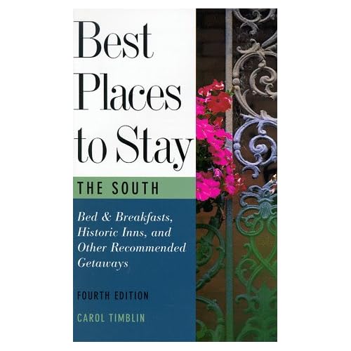 Best places to stay. Houghton. pap. $19. http://www.houghtonmifflinbooks.com/
These cover “best places” to lodge in North America and the Caribbean. Although oversized, they are well organized and provide much more diverse information than the series’ name suggests. Besides including the most luxurious hotels, the guides also emphasize the many rewards of lodging in smaller – and in many cases cheaper – hotels, inns, and motels. The maps are sloppy and sketchy. Locations covered include Florida, Mexico, Hawaii, and California. Updated biannually. 7 titles.
Writing *** Photos NONE Maps * Index ** Binding & Paper ** Ease of Use *** Insider Info ***
Charming Small Hotel Guides. Hunter Pub. pap. $12.95-$14.95. http://www.hunterpublishing.com/

This “charming” series sparkles with photographs that stress the beauty of the finest – but not necessarily the costliest – small hotels across Europe (by country) and the United States (by state). Most hotels get a full-page with a clear, revealing photograph, one or two beautifully written descriptive paragraphs and a shaded section with contact info., prices, etc. Librarians need not be put off by the guides’ petite size – these have been bound to last. Updated biannually. 12 titles.
Writing **** Photos **** Maps ** Index *** Binding & Paper *** Ease of Use **** Insider Info ****
 NEW! World Food. Lonely Planet. pap. $11.95-$12.95. http://www.lonelyplanet.com/
Meant “for people who live to eat, drink, and travel,” these include information on culture, the history of drinking, and each region’s specialties. They pay close attention to the way in which the culture is shaped by the food and vice versa. This series omits restaurants – except for a very few – but Lonely Planet makes up for this lack in another series on dining, Out To Eat. Planned to be updated biannually. 10 titles.
Writing **** Photos **** Maps ** Index *** Binding & Paper *** Ease of Use **** Insider Info ****
Guides for budget traveling
Cheap Eats & Cheap Sleeps. Chronicle Bks. pap. $12.95-$13.95. http://www.chroniclebooks.com/

These are all written by Sandra A. Gustafson, an avid traveler. Each guide kicks off with a list of valuable tips on traveling inexpensively, followed by extensive general travel information. “Cheap” does not mean shoddy but unextravagant and adventurous. Lacking photos, illustrations, or easily recognizable icons, these are laden with useful text. Besides offering plenty of information on lodging and dining, they also include a glossary and a section on low-cost but high-quality shopping. Updated biannually. 11 titles.
Writing *** Photos NONE Maps * Index *** Binding & Paper ** Ease of Use **** Insider Info ***
 Let’s Go. St. Martin’s. pap. $16.99-$23.99. http://www.letsgo.com/
This series dates back to 1960 when it comprised only one guide, Let’s Go: Europe. That title has since been updated 40 times and remains the world’s best-selling international travel guide. In fact, the series as a whole outsells all other budget series. The guides are packed with practical information, and their impressive range, high-quality maps, and laid-back, even humorous tone – especially appealing to students – make them comparable to the major general guides, with an emphasis on spending money wisely. A few annoying ads aside, this is, by far, the most comprehensive, authoritative budget series. Updated annually. 34 titles.
Writing *** Photos NONE Maps * Index *** Binding & Paper ** Ease of Use **** Insider Info ***
Mr. Cheap’s. Adam’s Media. pap. $9.95. http://www.adamsmedia.com/

This user-friendly, thorough series covers sightseeing, entertainment, shopping, dining out, and lodging. The sheer amount of insider’s information will please most bargain hunters, but the poor mass-market binding will not stand the test of circulation. Updated every three or four years. 7 titles.
Writing ** Photos NONE Maps NONE Index *** Binding & Paper * Ease of Use ** Insider Info *
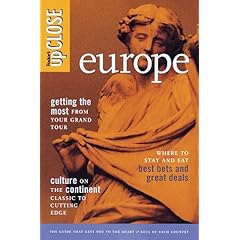 upClose. Fodor’s. pap. $13.50-$17.50. http://www.fodors.com/
Unlike other budget series, this one covers many off-the-beaten-path locations and emphasizes seeing locals and their way of life. Featuring a warm and amiable tone, these cover all aspects of economy travel. Similar to the Let’s Go guides, these, too, are sufficient in themselves, though they are aimed at a more traditional traveler. The format is a bit jumbled. Updated biannually. 15 titles.
Writing *** Photos NONE Maps ** Index *** Binding & Paper ** Ease of Use *** Insider Info ***